Categories
Uncategorized

Let’s Take a Look at Some SCARY Images

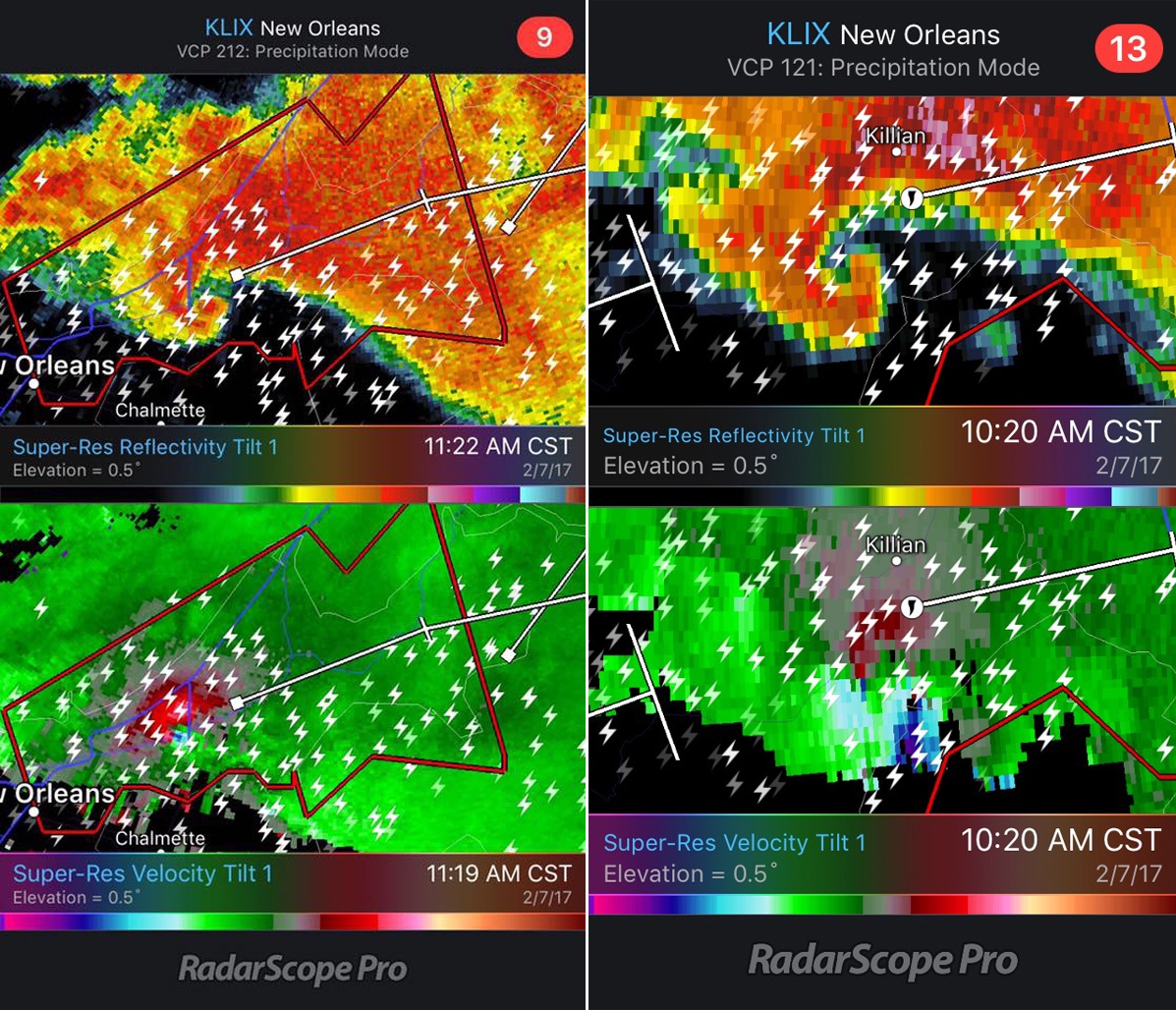
Weather can be scary for many, especially when there are severe thunderstorms. Luckily, understanding radar can help people understand better what type of weather is coming their way. This Halloween, let’s take a look at some eerie RadarScope images!
Categories
Uncategorized

Comparing Tornado Signatures from NEXRAD and TDWR

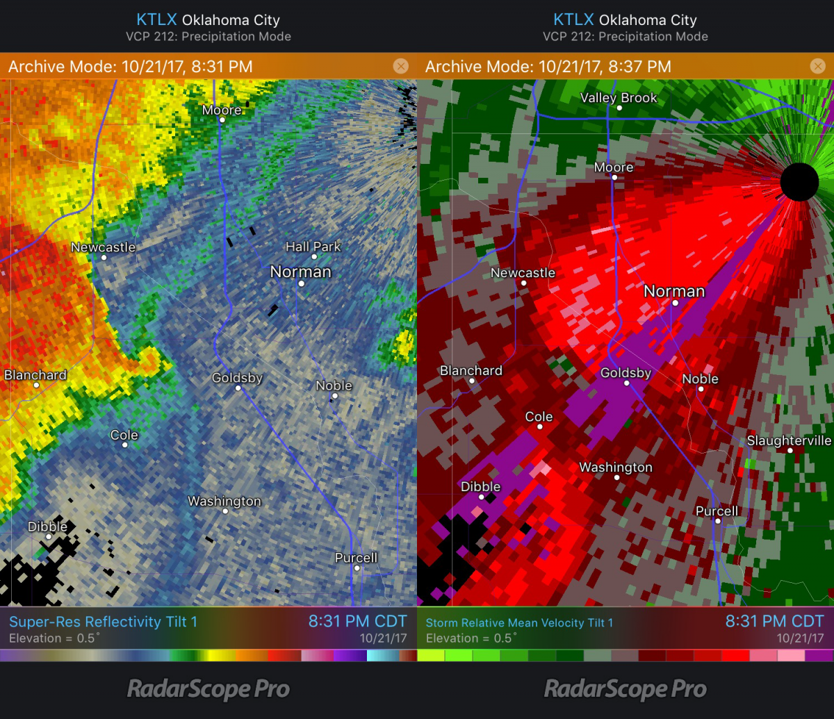
On October 21, a tornado developed southwest of Oklahoma City, near Goldsby, causing damage to a casino. Both a NEXRAD radar and a Terminal Doppler Weather Radar (TDWR) in the area detected the storm, but there are some notable differences in the radar images from each.

Categories
Uncategorized

October 14 Illinois Tornado

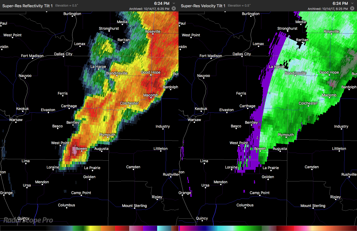
On October 14, 2017, a wind event occurred across Oklahoma, Kansas, Missouri, and Illinois. While some small hail was reported, the majority of storm reports were for wind damage associated with a strong cold front. Out of nearly 100 preliminary reports, 87 were due to wind. However, two reports were for tornadoes.

Categories
Uncategorized

Difference Between Hydrometeor Classification and Hybrid Hydrometeor Classification

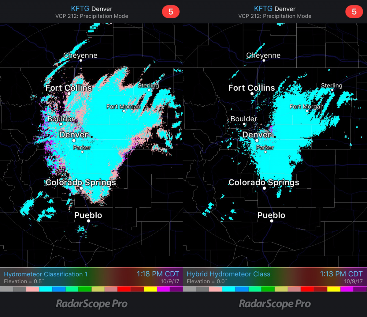
RadarScope provides both the Hydrometeor Classification and the Hybrid Hydrometeor Classification output. While both serve the same general purpose, identifying precipitation type, there are some fundamental differences between the two.