
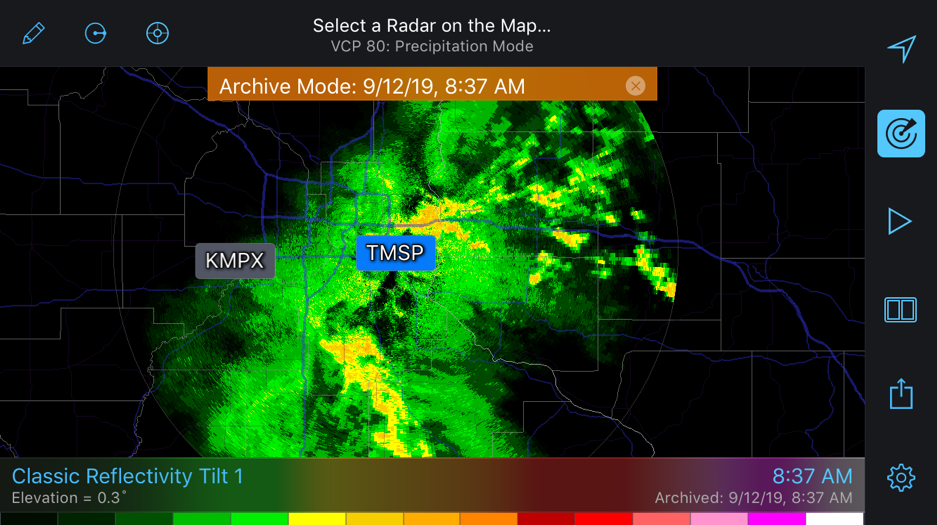
Each year, extreme and interesting weather conditions across the U.S. appear on radars and, therefore, RadarScope. Over the last few weeks, we asked our DTN meteorologists to pick their favorite radar images of the year. With more than 30 radar products and four different radar tilts across 155 Doppler Radars, more than 10,000 potential images are created every few minutes. We selected fifteen out of the millions of images created and presented them to the meteorologists for voting purposes. We guarantee we probably missed something cool, but here is what the DTN team selected for 2019.
RadarScope added support for snow squall warnings in June 2019, keeping users aware of changing conditions throughout the winter months. Snow squall warnings are intended to warn the public of reduced visibility due to lake effect and frontal snow squalls.
RadarScope serves as a connection point for a large community of users. In fact, we have our own user group on Facebook, where many RadarScope fans go to talk about, learn how to read, and post radar images. That group – like many – has developed their own language or key terminology. Many RadarScope fans are familiar with most of these terms or all of them, but new users may be scratching their heads to figure out what is going on in some of the comments/forums related to RadarScope.
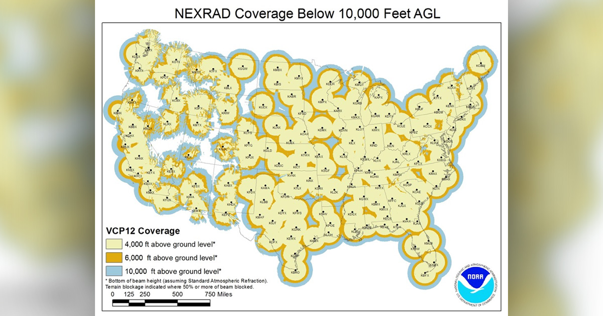
The deployment of NEXRAD radars in the early 1990s was a major step forward in being able to sample precipitation across the Continental United States. However, there are still some limitations within the dense radar network. Due to the curvature of the earth, radar beams cannot see the entire atmosphere as the horizontal beam coming out from the radar increases with height as it moves further from its origin.
From 1992-1997 NEXRAD, more specifically WSR-88D, radars were deployed across the entire country, giving meteorologists a national look at precipitation. Since the 1990s, radar data has become much more readily available to the public, forever changing and increasing the value of these radars. Radarscope uses such data from NEXRAD radars to produce the stunning images seen in the app today.
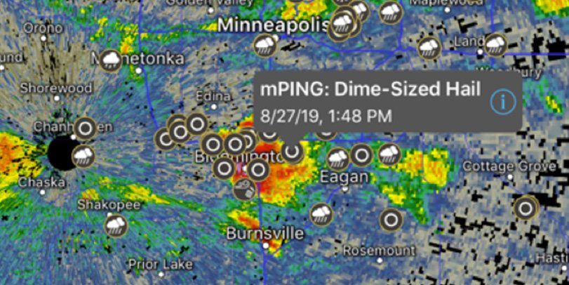
Similar to customer reviews, select advertising campaigns, and other initiatives, mPING uses crowdsourcing to collect useful data and, in this case, weather data. The initiative, mPING (Meteorological Phenomena Identification near the Ground) was implemented in 2012 by NOAA’s National Severe Storms Laboratory as a way to collect public weather reports. Think of it as Waze for weather.
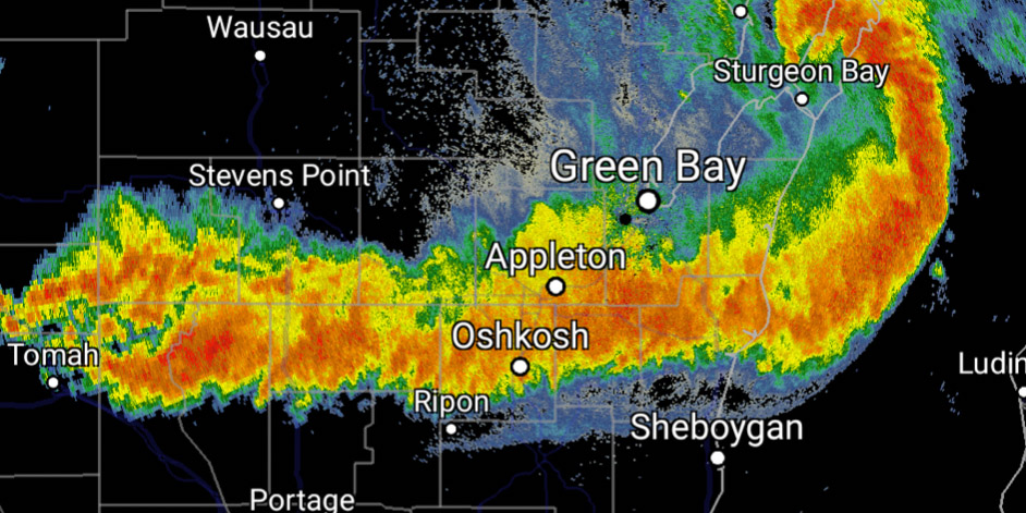
July 19, 2019, will be remembered in many locations throughout the Upper Midwest and beyond as the day that the heat indices reached well over 100 degrees and dew points in the 80s.
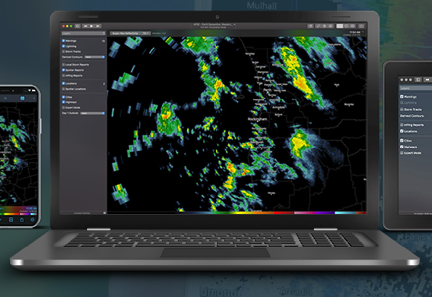
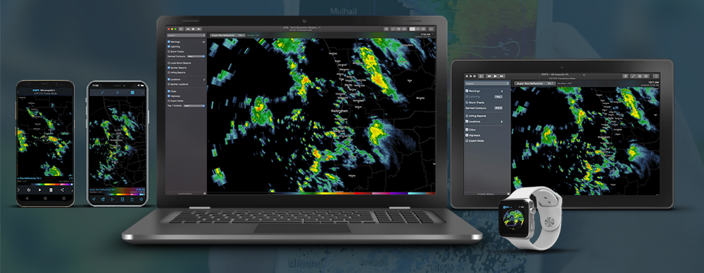
App allows users to access near real-time weather radar information across the country.
We’re pleased to announce RadarScope 3.9. It’s available today for iOS, macOS, and Android, with Windows and tvOS to follow soon. Today’s update includes many new features and improvements.


