
A Mesoscale Convective Vortex (MCV) is similar to larger-scale areas of low pressure except for the size. Typically they have a diameter of 30-60 miles, depth of up to 3 miles, and develop in the mid-levels of the atmosphere. Squall lines, or Mesoscale Convective Systems, are often the cause of their development.
It is thought that the development of an MCV begins as the squall line releases latent heat. As this latent heat is released, the air warms, and the density of the air decreases causing the pressure at the surface to fall. As the pressure drops, a cyclonic circulation develops that is visible in both radar and satellite imagery. MCVs usually develop when wind shear is weak, instability is strong, and in squall lines that are either mature or decaying. The MCV, shown below on RadarScope, developed near St. Louis, Missouri on July 15, 2018.
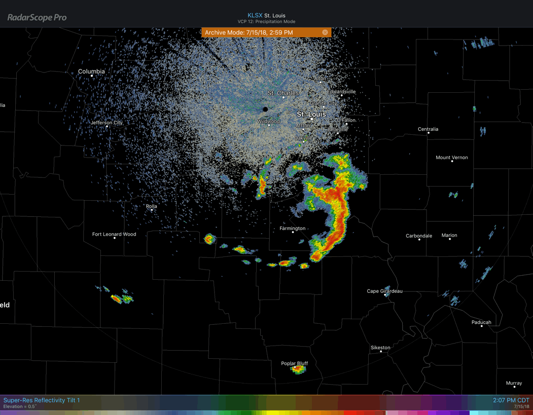
Radar Loop of an MCV
Satellite from a few hours earlier also shows this MCV.
Check out this MCV (Mesoscale Convective Vortex) across central MO. Otherwise, non-technical term a “swirly”. This will be the focus area for addition showers and storms possible later this afternoon. #MOwx #MidMOwx #sgf pic.twitter.com/eu1IY1jjJp
— NWS Springfield (@NWSSpringfield) July 15, 2018
MCVs are relatively rare, averaging 3-4 per year across the US and are sometimes erroneously referred to as “land hurricanes.” Although MCVs and hurricanes share some of the same traits, they develop by different mechanisms. While squall lines typically last a few hours, an MCV can continue on the order of several hours to several days, providing forcing for the development of thunderstorms throughout its lifetime. These spinning features can be identified in satellite imagery long after a parent squall line has dissipated.


