Categories
Uncategorized

What Does Differential Reflectivity and Correlation Coefficient Tell Us

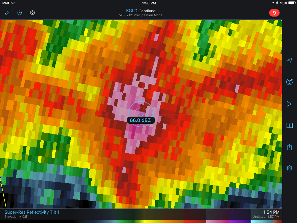
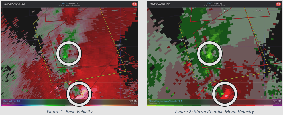
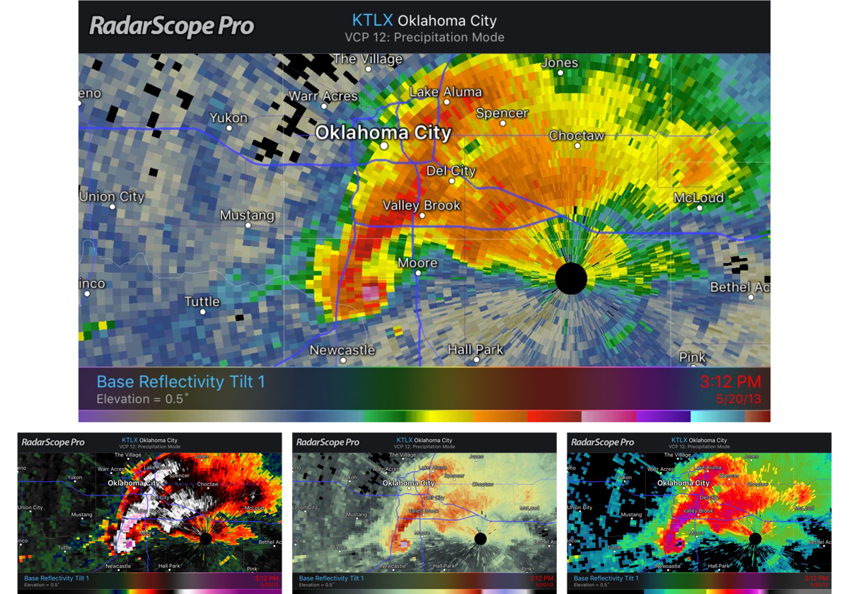
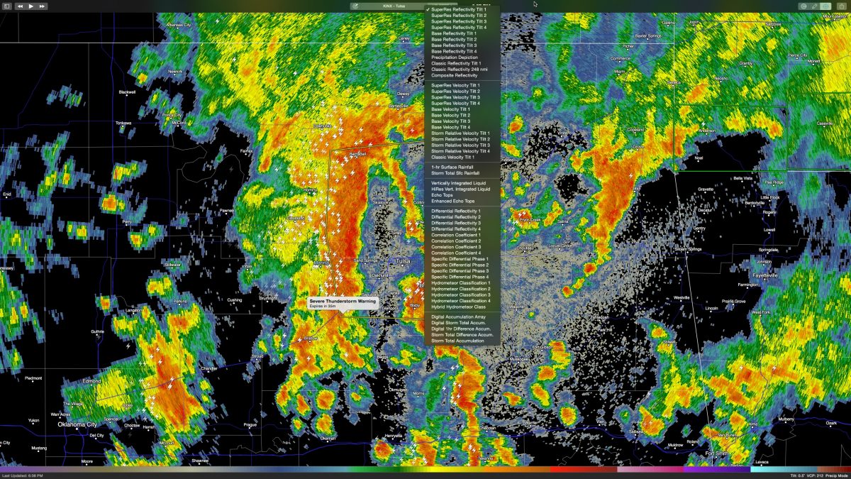
The dual polarization products available in RadarScope can help provide clues in determining what really is occurring in a storm. These products can tell you about the shape, orientation, and the uniform nature of what the radar is observing. In this blog, we will look at the Differential Reflectivity and Correlation Coefficient.

Categories
Uncategorized

RadarScope Pro – If You Don’t Have It, You’re Missing Out

Do you ever jump back and forth between reflectivity and velocity data on an interesting storm? Now you don‘t have to. Our last RadarScope Lunch & Learn webinar discusses the advantage to having Pro and also shows a few features you may not know about.

Categories
Uncategorized

What is Storm Relative Velocity?

If you’ve ever looked at your RadarScope velocity menu, you have seen super-res velocity, base velocity, and this product named Storm Relative Mean Velocity. But what is it and how does it differ from other velocity products?

Categories
Uncategorized

Hook Echoes: Why You Should Know What They Are

Have you ever heard your favorite television meteorologist mention the term “hook echo” and wondered what they were talking about? This term means something significant to meteorologists and weather enthusiasts. If one is occurring near your location, it should mean something significant to you too.

Categories
Uncategorized

Thoughts on Customizable Color Tables

During weather events, millions of people take to social-media platforms, such as Twitter and Facebook, to post and read about the adverse weather around them. From PhD meteorologists to middle-school aged weather enthusiasts, many users of social-media are posting screenshots of weather radar, and a large percentage of these screenshots are from RadarScope. We love seeing our app used as a catalyst for scientific exploration, public safety, and decision making!

Categories
Uncategorized

Identifying Between Rain, Sleet and Snow

Winter is in full swing and that means we’re experiencing a wide range of weather. Heavy rain, freezing rain, sleet and snow, we’ve got it all. Often, especially in the early stages of an event, more than one precipitation type is being produced. In winter, there can be a transition line from liquid precipitation to frozen precipitation.

Categories
Uncategorized

Freezing Rain, Sleet or Snow? RadarScope Can Help

During the warm weather months, you probably use WDT’s RadarScope app to watch strong storms roll in. During the winter months, however, you may be more concerned with the type of precipitation falling rather than its intensity. Either way, RadarScope has got you covered.

Categories
Uncategorized

RadarScope Usage on Big Severe Weather Night

Users fled to RadarScope to track yesterday’s big severe weather event that resulted in over 40 tornado reports across parts of Kansas, Texas, Oklahoma, and Nebraska. The following is a look at RadarScope usage during the event, including peak usage during the event, which radar sites were used most, and products most requested.

Categories
Uncategorized

RadarScope 2.3 for Mac – In action!

Tonight the first strong cold front of the fall season is pushing across the plains states firing off a potent round of severe storms. Fortunately the primary threats are only high winds and flooding. No tornadoes.
Categories
Uncategorized

RadarScope Featured in Apple iPad Air Advertisement

The banner you see above displayed at Apple.com for the first time on Sunday as Apple released their latest advertising push for the iPad Air. We here at WDT are extremely excited to see the inclusion of our very popular radar display app, RadarScope, in the newly released 1:30 ad. Check it out below!