Categories
Uncategorized

RadarScope for Windows Progress Report

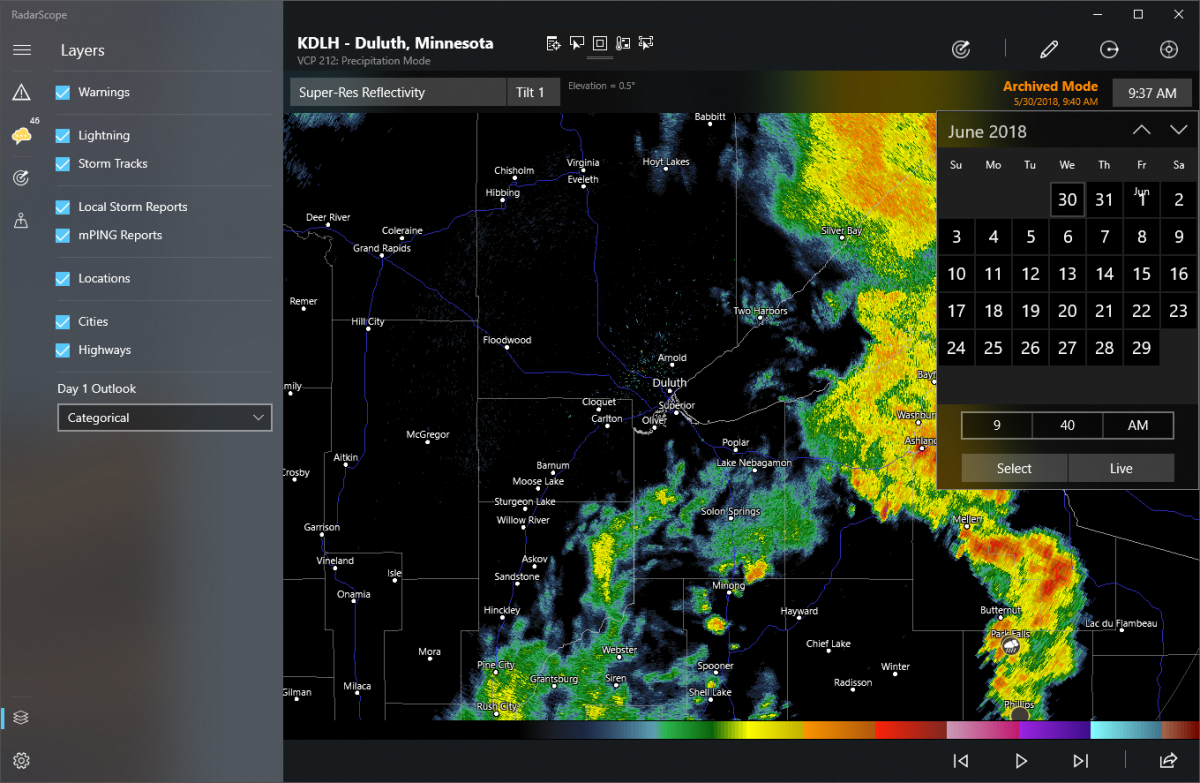
We released RadarScope 1.0 for Windows in April and have been extremely pleased with the response. We’ve been working on RadarScope for iOS for ten years, and on macOS and Android for seven years. Version 1.0 for Windows took about a year from conception to release, so we weren’t able to include every feature from the other platforms. We’re developing those features and look forward to reaching parity with the macOS app later this year. Here’s a brief update on our progress.

Categories
Uncategorized

Users Group Survival Tips

The RadarScope Users Group on Facebook is a forum for current and prospective customers to learn— from one another and us—about the app, how to use it, and how to better interpret radar and related weather information. At its best, it’s a friendly and welcoming community with a mix of beginners who want to learn, and more advanced users who want to help them. It’s not about education level or professional experience. Severe weather affects everyone. RadarScope was designed from day one to bridge the gap between the novice and expert user, making it easy to access the most commonly used features while progressively exposing new features as users grow to understand and rely on them.

Categories
Uncategorized

Some Apps have Easter Eggs” – We Have Running Rabbits!”

Occasionally, long streaks can be observed on reflectivity images. These streaks are a type of interference known as bistatic coupling, or “running rabbits.”

Categories
Uncategorized

To Run or Not When Rain is Falling

The 5:00 a.m. wakeup call to go for a morning run sometimes leaves a runner looking for any excuse to go back to bed. One recent morning, the forecast had a chance of rain. The first thing I did that morning was to check my Radarscope app. Radarscope can be a handy tool for showing my position relative to the precipitation.

Categories
Uncategorized

Android Fix is Coming Today

We’re releasing RadarScope 3.7.3 for Android today to address the location services issue and a few others. Several changes have been made in an attempt to improve location services behavior. When RadarScope is denied location services at the requested accuracy level errors occur. We’re now trying again with a lower accuracy level. If that fails, we will advise users to change their location tracking settings to a higher level.

Categories
Uncategorized

How are Storm Tracks Computed?

NEXRAD radars employ algorithms to calculate a predicted track of a storm. The calculation of these tracks begins with the algorithm, known as Storm Cell Identification and Tracking (SCIT).

Categories
Uncategorized

Wind Farms, Smoke, and More

The third part of the series will focus on various forms of ground clutter and miscellaneous things like smoke and chaff. Ground clutter is generally characterized by isolated, noisy large values of reflectivity and velocity that move very little if at all. Sometimes there will be pixels of missing/no data/zero within a group of pixels with high values. The correlation coefficient is generally very low, and differential reflectivity tends to be near zero but can be variable. When watching a loop, it tends to suddenly appear and disappear in the same area, rather than moving. Some ground clutter is almost constant, but in general, it tends to be worst during the night or early in the morning. Smoke and chaff can be most readily distinguished from precipitation by the low correlation coefficient. Satellite data can also be helpful for determining if there is a fire or significant cloud cover in the area of interest.

Categories
Uncategorized

Birds, Bats and Bugs

In this second part of the series looking at common non-precipitation radar echoes, we will look at several examples of biological scatter, including birds, bats, and insects. Dual-polarization data is usually the best way to distinguish biological echoes from precipitation, especially in a static image. These types of echoes generally have low a correlation coefficient and high differential reflectivity. The following can help identify what kind of creatures are responsible for specific common patterns of biological echoes in radar data at certain times of the day or year.

Categories
Uncategorized

Managing Custom Locations in RadarScope for Windows

When bringing RadarScope to a new platform, we try to strike a balance between RadarScope’s unique personality and the way customers expect an app to behave on that platform. While features behave similarly across iOS, macOS, Android, and now Windows, the user interface often differs from one platform to the next. With that in mind, let’s take a look at how custom locations are added, managed, and displayed in RadarScope for Windows.

Categories
Uncategorized

Using mPING to Report Hail

Spotters and storm chasers can provide a treasure trove of information useful to NOAA National Severe Storms Laboratory (NSSL) researchers by reporting what you see through RadarScope. Tornado sightings are extremely helpful for both warning purposes and research purposes. While it’s hard to imagine, not all the tornadoes you see get reported and make it into databases. But one of the most challenging severe storm aspects to capture is hail information.